Drones or Unmanned Aircraft Systems (UAS)
How we use drones
We use drones – or unmanned aircraft systems (UAS) – to help us look after the railway. That’s 20,000 miles of track and 30,000 bridges, tunnels and viaducts.
How? By surveying the railway for regular maintenance or following an incident – safely and efficiently.
Our drones gather data, videos and images of the railway so we can better understand the problem in a certain location and what repairs we need to carry out. Our aim is to predict and prevent faults before they affect the normal running of trains.
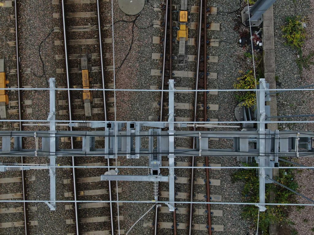
Using drones for close-up inspections means we can reach areas that are usually difficult to access. These include roofs, bridges, coastal areas, the overhead wires that power electric trains and communication masts.
Inspecting the railway by air means we can keep lines open to train services and keep our people safe because we’re not sending engineers out on track unnecessarily.
Enhancing our systems
We’re improving our use of drones so we can deliver even more maintenance, upgrades and construction projects – and much faster.
A new flight management system will allow us to carry out significantly more drone flights every year. This will help our engineers on the ground by giving them even more information and lead to a better, more reliable and safer railway for you.
We carry out hundreds of drone flights a year, with a 10-day turnaround between flights. The new system means we can turnaround flights on the same day and in most cases, within the hour.
It will also enable us to send drones much further than before, beyond our current visual line of sight (BVLOS) permissions – beyond where the pilot can see the drone. This will hugely help our engineers monitor track, for example – and keep it safe and reliable for your train journeys.
Increased safety
One of the major benefits of our new flight management system will be removing the potential for human failure, which poses safety risks.
With the number of drone flights at the level it is and only going to climb higher in the future, we need a system like this to manage the load to ensure we are as efficient and safe as possible.
The [flight management system] will show drone pilots if another drone is operating nearby, as well as alert the pilot to other potential ground or air hazards in the area of the flight.
Rikke Carmichael, head of Air Operations
Our drones in action
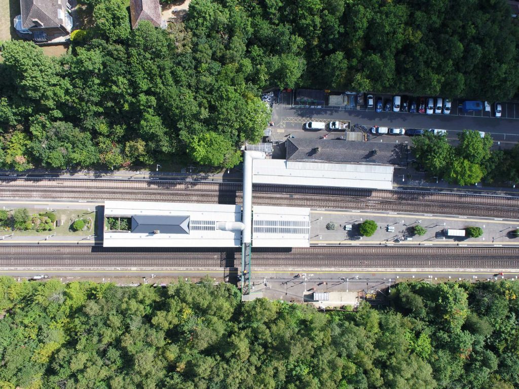
Electrifying the Great Western Main Line
Aerial images taken by drones helped us record our electrification of part of the Great Western Main Line. We’re been upgrading this line, designed by Isambard Kingdom Brunel, to enable train operators to run electric trains. Electric trains, which are greener and quieter than diesel trains, need to get their power from overhead line equipment.
We used drones to document the work in large aerial images without going onto track once the line had opened again to trains.
Edenbridge landslip response
A landslip at Edenbridge in Kent closed the railway in December 2019. The incident was one of the largest in the history of this region’s railway and the challenging repairs lasted until March 2020.
The drone gave us aerial access to a landlocked area and three train tracks, giving us a greater overview of the damage. This meant the engineers could see how they needed to respond, helping them plan the site’s recovery much more quickly. It also meant we could show passengers the scale of the damage and why it would be impossible to run trains for months.
Hither Green
We completed a huge project to make signalling more reliable through Hither Green in London in August 2020. Two years of work involved replacing a 1970s signalling system that had become unreliable and hard to maintain.
Our drones helped show you what work we had carried out to improve your journeys. The new system, controlled from a state-of-the art centre at Three Bridges, will mean fewer faults, fewer delays and better journeys between Kent, Hither Green, Lewisham and into Central London.
Our drones – vital statistics
- Range – this is dependent on the size of the drone and conditions you are operating in. All operators must maintain VLOS with their airframes and know the orientation of said airframe at all times
- Flight – permitted to fly up to 400 feet high – slightly higher than St Paul’s Cathedral
- Camera – varies on mission and can include high-definition, 4K video imaging and high-resolution stills camera systems.